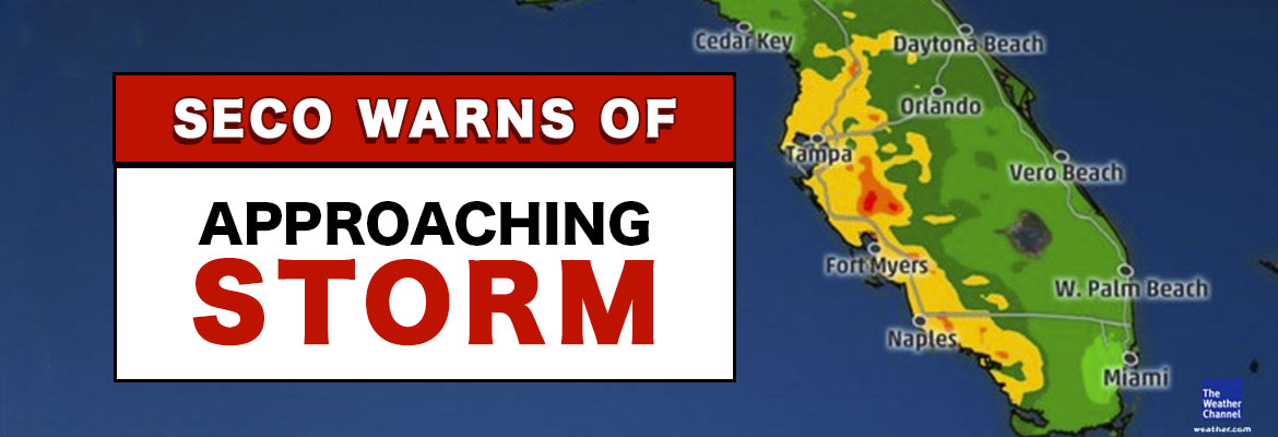
Tropical Storm Colin – Sunday evening update
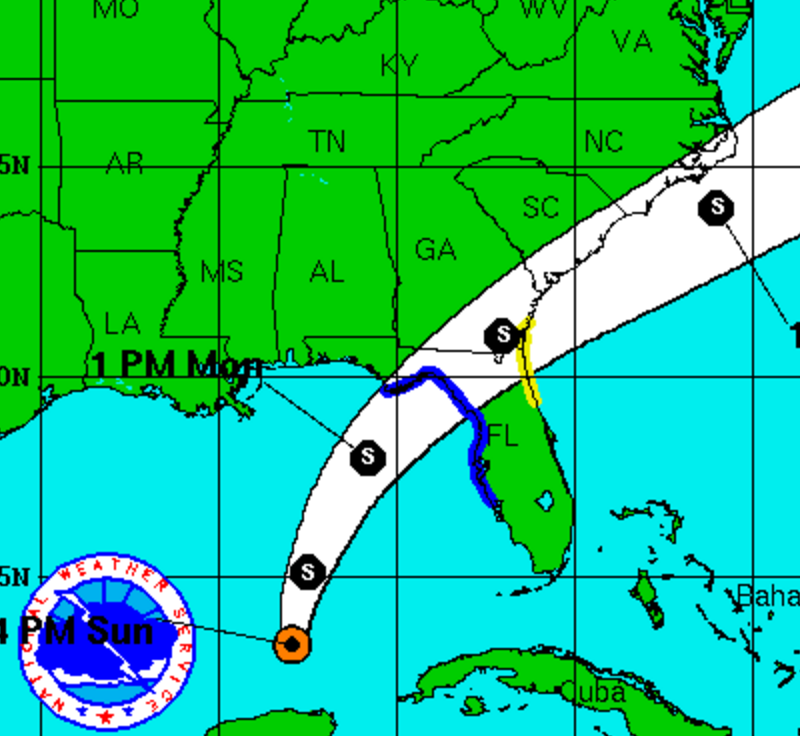
The National Hurricane Center has upgraded the tropical depression to Tropical Storm Colin. The TS is now moving north at approximately 8 mph and is projected to make landfall in the Big Bend area of Florida. All models continue to focus on that area – see attached. This storm is lopsided with all the severe weather on the east side of the storm system and nothing on the west side. This means the worst rain and wind is on the side of the storm that will pass by or on top of SECO Energy.
The current track of TS Colin means that Citrus, Marion and Sumter Counties can expect the worst impact from the storm. Lake County will still see periods of rain and rain bands from TS Colin – just not as severe as the other SECO Energy counties. Since TS Colin is moving slow, it may be late on Monday before SECO sees the worst. The rain bands extend many miles to the east and north. The wind forecast for our area remains unchanged – sustained winds around 20 mph with stronger gusts in thunderstorms. SECO is STORM READY. Please be sure your phone is charged and that you bookmark our Storm Center link to report outages online.
Kathryn Gloria, Vice President of Corporate Communications and Energy Services is reminding members that SECO is Storm Ready for its members. “SECO is prepared for the almost daily afternoon storms that affect our service area and we are prepared for stronger storms as well. As a not-for-profit electric cooperative, we are dedicated to being our members’ first source for accurate storm information. “Like” SECO’s Facebook page and “follow” us on Twitter to stay updated about storms affecting our members.”
For members who rely on back-up generators during storm season, remember to read and follow all manufacturer’s safety warnings. Visit SECO’s website to learn more about generator safety and preparing for storm season.